
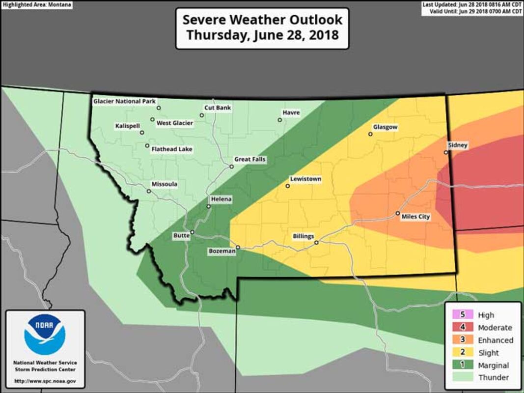
If you are in the Yellow, Orange or Red area in the map, you need to be ready for severe thunderstorms later today (Thursday, June 28, 2018). It's been several years since we last had a MODERATE risk (red area) of severe thunderstorms.
• The greatest threat is damaging winds with gusts to 75 mph or higher possible. The next threat is hail, up to baseball size. There is 10% probability of tornadoes, but that is mainly along the North Dakota border and eastward.
• Heavy rain is also an issue. If you have areas that tend to flood, you may want to notify your public works/road departments that there could be issues later today. Some areas could see up to 2" of rainfall in a short amount of time.
• You could see more than one round of severe thunderstorms coming through this afternoon and evening.
• We expect things to start after 1 pm today in Montana (North Dakota already has severe storms this morning and will continue to see storms through the day).
• The worst of the storms looks to be from 6-10 pm this evening.
• Please send us reports of severe weather through the following methods: 800-775-5771 (or local number 406-228-4042), Facebook: https://www.facebook.com/NWSGlasgow/, Twitter: https://twitter.com/NWSGlasgow, or email photos/videos: [email protected]. With all methods please include the following: Who you are, where you are, what is happening and time of the event.
• Safety: Here's a quick presentation to remind you of how to be safe during severe thunderstorms: https://www.weather.gov/media/wrn/presentations/Summer_Safety_Presentation_2018.pdf


Reader Comments(0)